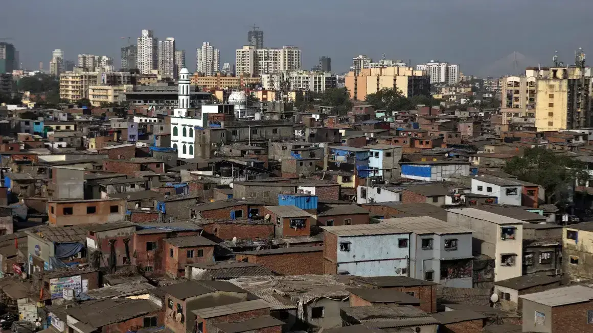
The Telangana government has launched an advanced LiDAR survey under the ‘One Map Hyd’ project, aiming to create a comprehensive database of Hyderabad’s infrastructure. The initiative seeks to consolidate critical urban data, covering road networks, water supply, electricity, sewage, fire services, and traffic police infrastructure. By employing precise three-dimensional mapping, the project is expected to improve urban planning, enhance infrastructure management, and strengthen disaster response mechanisms.
Chief Minister A Revanth Reddy has mandated that the survey cover the entire Greater Hyderabad Municipal Corporation (GHMC) area and extend up to the Outer Ring Road (ORR), encompassing approximately 2,050 square kilometers. The objective is to develop an accurate, high-resolution digital map that can serve as a reliable reference for various government agencies. This will aid in optimizing resources, streamlining developmental projects, and improving service delivery across multiple sectors.
LiDAR, or Light Detection and Ranging, is a remote sensing technology that uses laser pulses to measure distances and generate highly detailed topographical data. It is preferred over traditional drone surveys due to its superior precision and ability to capture extensive terrain details, including elevation variations and built-up structures. The GHMC had previously conducted a drone-based Geographic Information System (GIS) survey covering 625 square kilometers to identify unassessed properties and improve revenue collection. While the drone survey provided useful insights, the LiDAR survey will offer more comprehensive and accurate data, particularly for expanding urban areas beyond GHMC limits.
The municipal administration and urban development department are in the final stages of the tendering process, and work is set to begin shortly. The survey within the GHMC region is expected to be completed within six months, while the mapping of the ORR area will continue until the end of the year. The data collected will be processed and integrated into a centralized digital platform, making it accessible to multiple agencies involved in urban planning, disaster management, and infrastructure development.
The Telangana government envisions this project as a game-changer in city governance. By digitizing critical infrastructure information, authorities will be able to streamline construction approvals, monitor unauthorized developments, and improve emergency response strategies. The availability of high-resolution geospatial data will also facilitate better traffic management, efficient waste disposal planning, and optimized utility services.
A similar initiative, the One Map Gurgaon project, has been implemented in Gurugram, Haryana. It serves as a single platform for geospatial data integration, assisting authorities in planning and decision-making. Hyderabad’s ‘One Map Hyd’ initiative follows a similar approach but extends the scope by leveraging LiDAR technology to enhance mapping accuracy. By adopting best practices from such projects, Hyderabad aims to create a robust urban information system that can support long-term planning and smart city initiatives.
The government is also considering a mobile application to provide real-time access to infrastructure details for both officials and the general public. This will enable better civic engagement and ensure transparency in governance. Citizens will be able to access information regarding their locality’s infrastructure, pending approvals, and planned developments.
In addition to LiDAR mapping, the GHMC had initiated a door-to-door property assessment last year to enhance its database. The integration of these datasets will create a robust urban information system that can support long-term planning and future smart city initiatives. Officials believe that the insights gained from the survey will enable better coordination between different government departments, reduce inefficiencies, and ensure sustainable urban expansion.
As Hyderabad continues to grow, precise data on land use, infrastructure, and utilities will be critical in shaping policies and executing projects efficiently. The One Map Hyd project, backed by LiDAR technology, represents a significant step toward data-driven governance, enabling Hyderabad to address urban challenges with greater accuracy and efficiency.